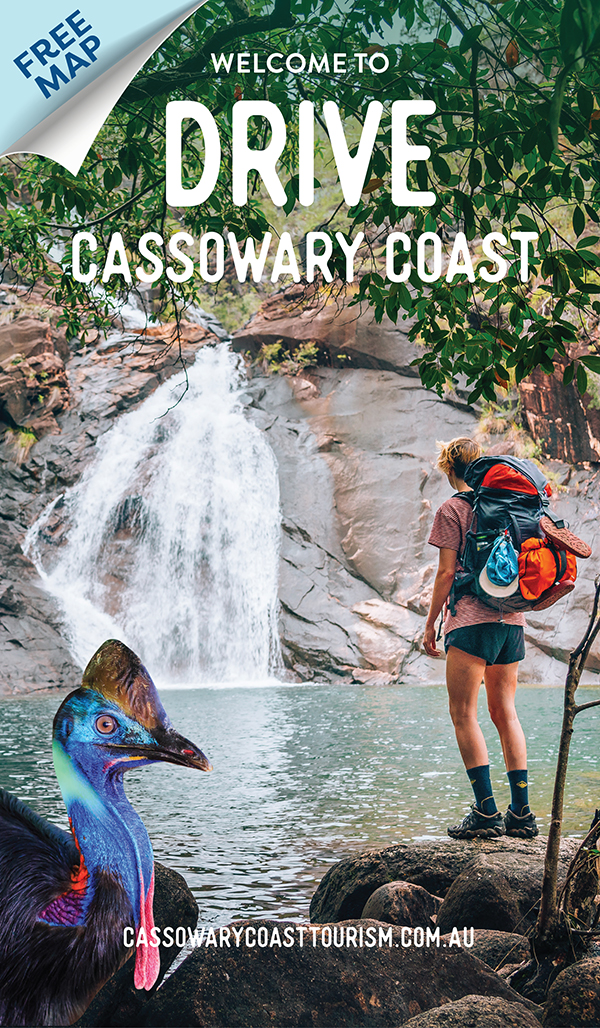
DRIVE ITINERARIES
CASSOWARY COAST
CASSOWARY COAST
THE CANECUTTER WAY
They call it the “Greatest Detour in the North”, but you’ll soon find out that The Canecutter Way is much more than that. It follows the route of the Old Bruce Highway, running between Kurrimine Beach in the south and Innisfail in the north. The Canecutter Way passes through thriving rural communities, vast sugar-cane fields and fruit orchards, and into historic towns. It’s only a short drive, but take your time and discover the unique delights of the Cassowary Coast region.
DAY 1 – KURRIMINE BEACH TO MENA CREEK – 31KMS
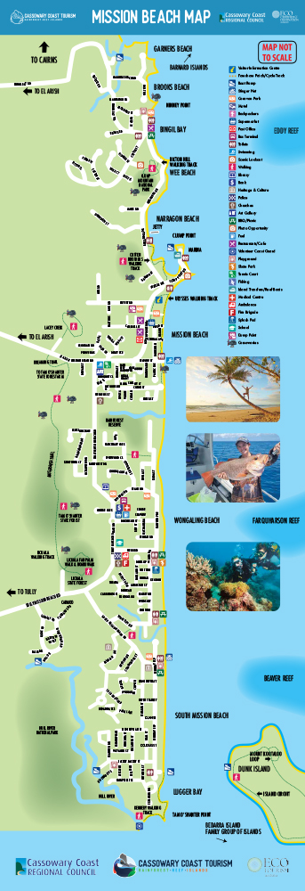
Kurrimine Beach, a picturesque fishing village that’s well off the tourist map, is one of the few places in the region that you can access the Great Barrier Reef from the shoreline. The reef is so close that at very low tide you can walk out to the local stretch, King Reef (you’ll need to wear sturdy shoes). Stroll along the town’s often-deserted beach to spot manta rays cruising through the shallows or turtles coming in to nest, and throw a line out at one of the area’s many fishing spots.
Start your journey by heading inland towards the historic sugar-cane farming community of Silkwood. Here, you can visit the smallest bank in the country, now a museum, as well as other heritage buildings from the town’s heyday.
The Canecutter Way continues on through the heart of Tropical North Queensland, past rolling farmland, along Liverpool Creek and through the town of Japoonvale. The unique name is thought to come from an Aboriginal word describing eels.
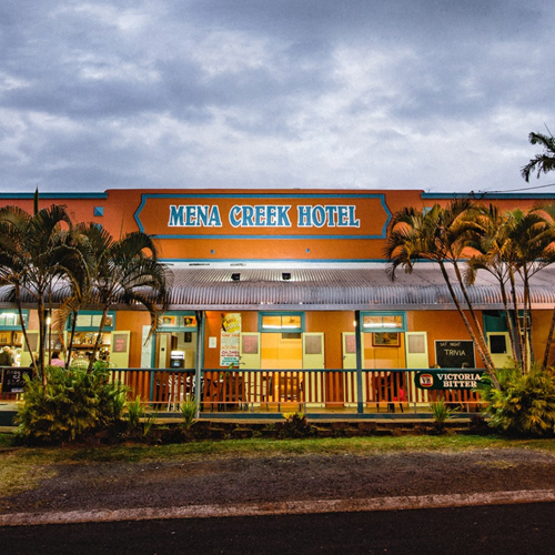
Your first overnight stop is Mena Creek, a sugar-cane town that dates back to the early 1900s. At the end of the day, join the locals for a drink in the Mena Creek Hotel, a classic Queenslander-style watering-hole that was named Best Bush Pub in the state in 2017.
DAY 2 – MENA CREEK TO INNISFAIL
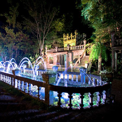
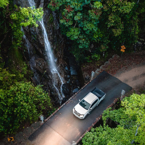
Today you’re visiting the one-of-a-kind Paronella Park, a magical Spanish castle and “pleasure garden” hidden among the rainforest. Built in the 1930s, it was the dream of Catalonia-born José Paronella, a former cane cutter who created a lush paradise of tropical gardens, exotic plants and winding paths, set around a spectacular waterfall. Take a tour to hear José’s incredible story and learn the fascinating history of this extraordinary folly.
This is the westernmost point of the drive, so now make a gentle turn and head north-east back towards the coast. The road passes through South Johnstone, another historic sugar-cane centre.

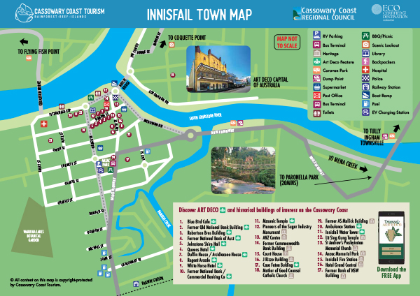
Your mini-road trip finishes in Innisfail, the largest town on the Cassowary Coast. Most of the town was destroyed by a cyclone in 1918 and had to be completely rebuilt, making Innisfail the art deco capital of Australia. Wander through the centre where the streets are lined with charming brightly coloured buildings. The self-guided art deco walk can be done by downloading the 'Tropical Art Deco' app or using the free brochure provided at the visitor information centres.
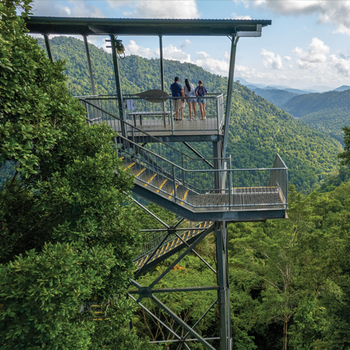
Finish your trip at Mamu Tropical Skywalk, located in Wooroonoon National Park, about 15 minutes from town. Wander along the 350m-long elevated walkway through the rainforest canopy, and take in the view of the North Johnstone River Gorge from the 37m-high observation tower.
OPTIONAL SIDE TRIP – ETTY BAY
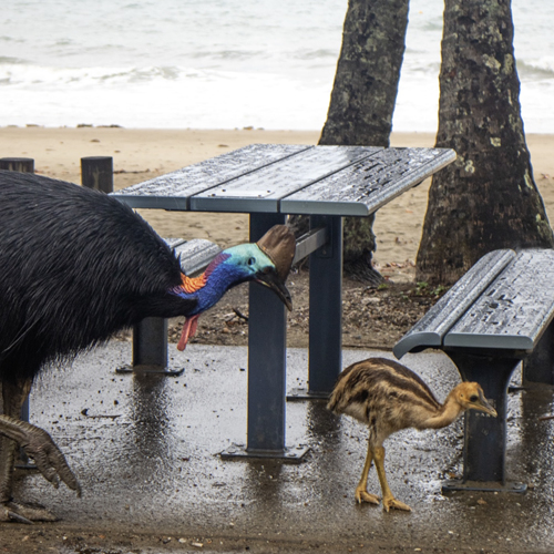
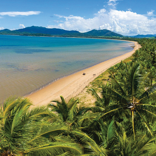
Etty Bay, 15km from town, is one of the prettiest beaches in Tropical North Queensland, with a gently curving arc of fine white sand backed by emerald rainforest. It’s also the place to spot cassowaries, the giant native bird that gives this region its name. These strange creatures can often be seen walking along the shore or even down the road. They are generally unperturbed by humans, but you’ll still need to keep a safe distance – there’s a good reason cassowaries are one of the most dangerous birds in the world.
CASSOWARY COAST
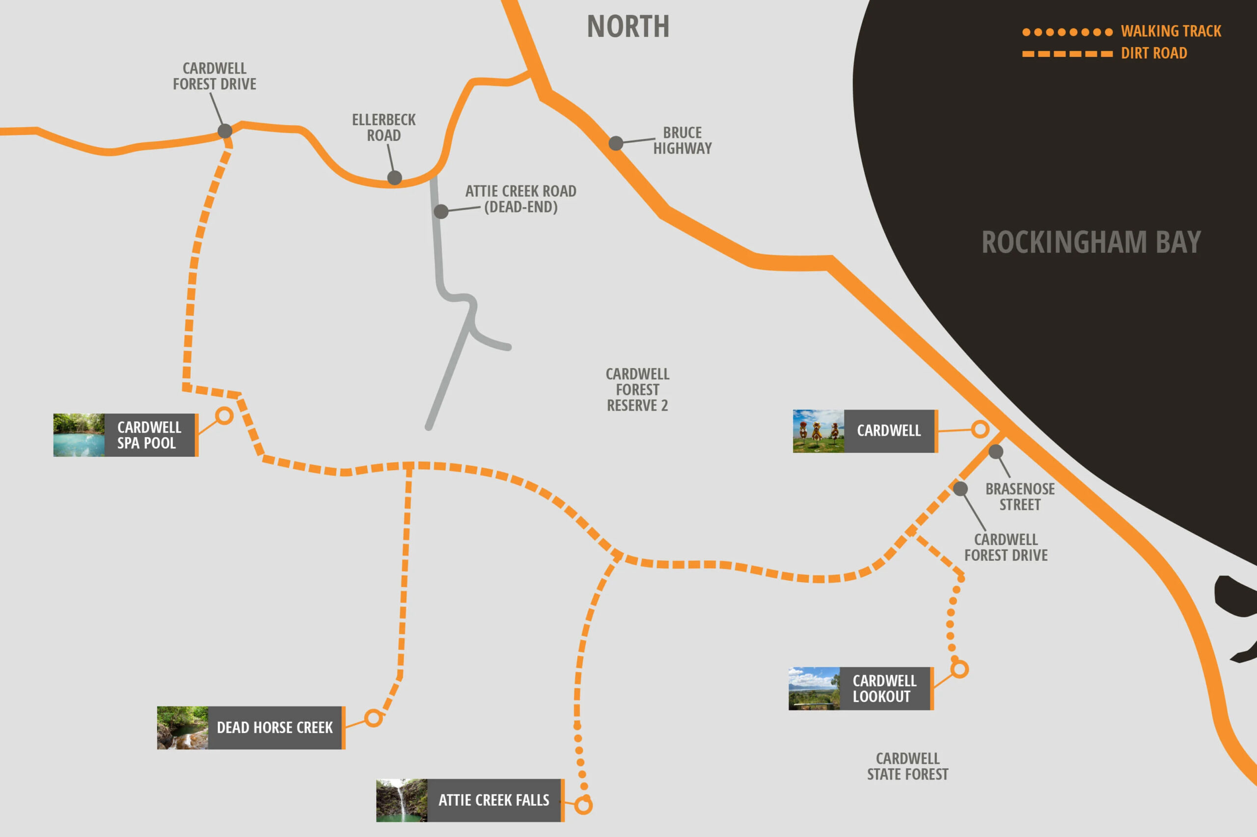
cardwell forest drive
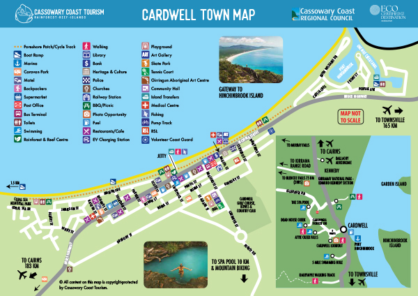
The Cardwell Forest Drive is a 26 klm scenic drive, starting at the town centre and covering lookouts, fresh water swimming holes and idyllic picnic spots. Easy to follow signs mark the way and you’ll discover delights such as Cardwell Lookout, Attie Creek Falls, Dead Horse Creek and Spa Pool along the way. Its beautiful water holes, natural spa pool and picnic facilities provide an enjoyable drive for all with wonderful bird watching and bush walking opportunities. Set aside at least half a day to enjoy all the Cardwell Forest Drive has to offer.
THE HIGHLIGHT OF THE DRIVE
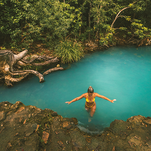
Cardwell Spa Pool is a naturally-fed, seasonal creek that shot to stardom on social media in 2016. Ever since, people have been adding it to their holiday itinerary but there are a few things you might not know about this idyllic swimming spot.
The Cardwell Spa Pool is a geological wonder, located in the beautiful coastal town of Cardwell in Tropical North Queensland. Although locals have been cooling off here for years, this magical swimming hole remained relatively unknown until a social media post went viral.
Cardwell loves welcoming visitors from near and far and although there is plenty to do all-year-round, the spa pool is a naturally fed, seasonal creek so water levels do fluctuate throughout the year. May to September is the best time, although wet season rains during the Summer months will usually flush the creek out, returning it to normal levels from around March each year.
CASSOWARY COAST
KIRRAMA RANGE ROAD
Opened in 1941, the Kirrama Range Road was designed to facilitate the transport of timber from logging camps in the Kirrama State Forest to Cardwell. Taking three years to complete, it was considered a feat of engineering due to the steepness of the terrain and the wet climate. Today it’s a stunning drive across the ranges, with plenty to see and do, and spectacular scenery including lookouts, waterfalls, heritage-listed rainforest and swimming holes.
CARDWELL TO BLENCOE FALLS – 75KMS
Today the drive is less than three hours, past cane fields that thin out to lowland eucalyptus scrub, replaced by lush tropical rainforest as you begin the climb up the range. At about 20km, stop at the look-out for a panorama over the Kennedy Valley and out to Hinchinbrook Island. There’s a monument here dedicated to George William Tucker, a surveyor involved in assessing the region in the 1930s before the road was built, who tragically died when he toppled over a steep ledge in the darkness.
At the very top of the range, the former timber settlement of Society Flat has unlogged sections with an easy 730m rainforest circuit walk to see magnificent giant kauri pines and rose gum trees.
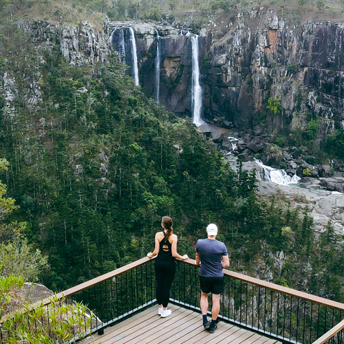
As you approach the Girringun National Park, there’s another abrupt change in terrain and vegetation, from mountainous forest to open savannah grasslands. Girringun is home to Blencoe Falls and, while not widely known, the falls are rated among some of the most spectacular in the country. They cascade, seemingly in slow motion 90m to a pool below, where they fall another 230m to the gorge floor. Set up camp creekside at the picturesque Blencoe campground before setting out for a closer look at the falls. There’s a choice of an easy 20-minute stroll or a 5km return walk. Tonight, enjoy the clear starry skies and let the unique sounds of the forest lull you to sleep.
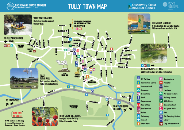
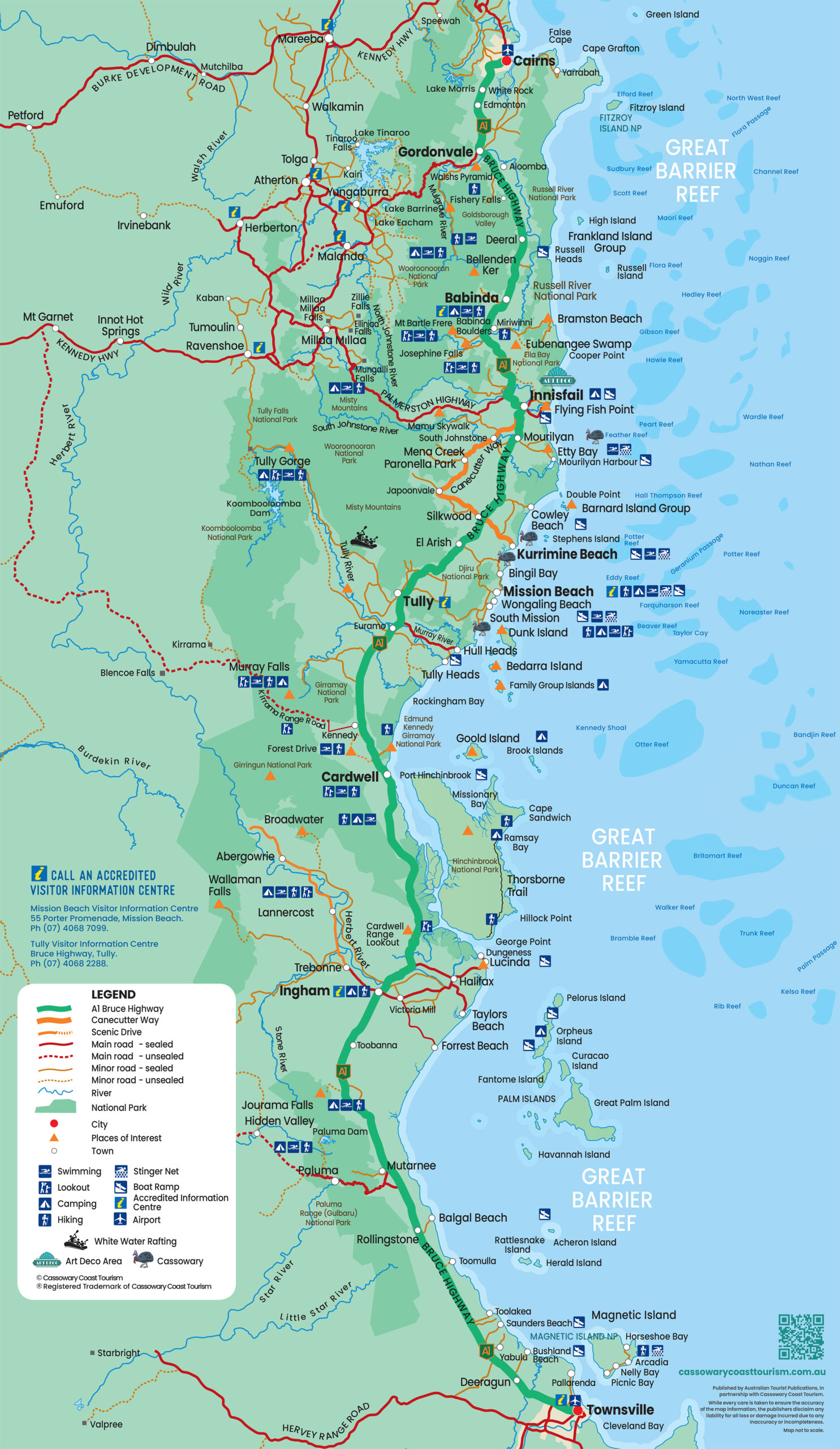
CASSOWARY COAST MAP
DOWNLOAD PDF MAPS AND GUIDES